
The Inventory of Methodist buildings published in 1940 includes an entry for a United Methodist chapel in Washwood Heath. The building was brick built and seated 367 people on pews. In addition to the main hall, there were 2 Sunday school rooms and 6 other rooms. In 1940 it was in the Birmingham (Small Heath and Washwood Heath) circuit.
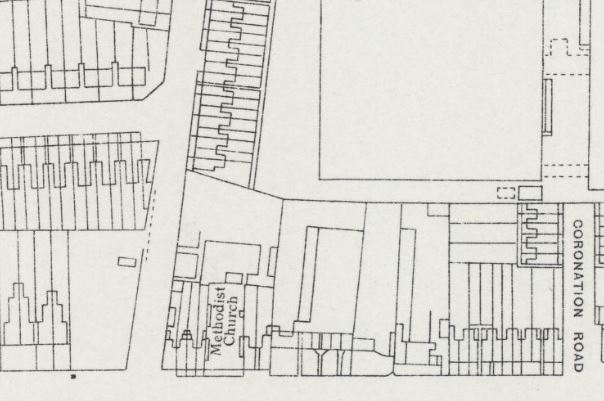
Where was the chapel? The 1886 Ordnance Survey map shows a chapel on the northern side of Washwood Heath Road, just to the east of Common Lane. By the 1902 map, there is an enlarged building on the site, labelled “Meth chap (Free United)”. The building is still there on the map published in 1945, but Street View from 2008 shows sheltered housing on the site.
However, the 1945 map shows a substantial building on the rear of the chapel, accessed from Common Lane. That still exists, in use by East Birmingham Youth Offending team. Was that a Sunday school?
Comments about this page
I was a regular attendee with my family until c.1974 when the church was demolished. I was married there in 1970 and my first child was christened there in 1972. I am trying to locate a photograph of the church but so far have been unsuccessful. I wondered if you could help?
By the way Washbrook Road in your narrative should be Washwood Heath Road. (Thanks – corrected -CH)
Regards Roy Shakespeare.
Add a comment about this page