

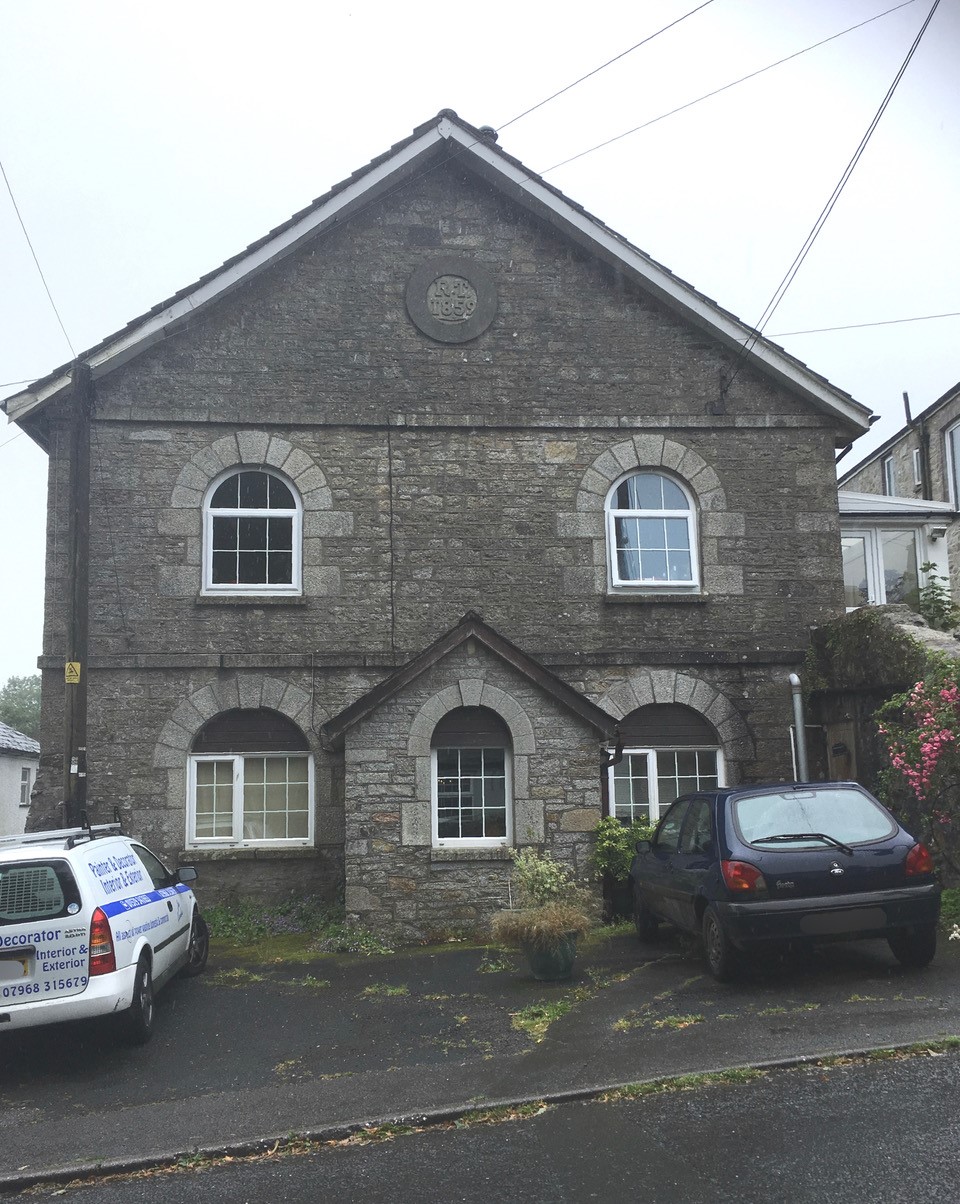
The chapel belonging to the St Cleer United Methodist Free Church was built in 1859.
In 1907 it became St Cleer United Methodist Church on the union of the UMFC with the Methodist New Connexion and the Bible Christians. It is in the centre of the village on Well street and was converted to a dwelling some time ago.
The church closed in 1916.
That’s what we thought the story was – but see the comments below. The problem is that the building in the picture is not where the chapel is shown on old Ordnance Survey maps, but it does look like a chapel and is even called The Old Chapel on a contemporary map.
If you can help, please add a comment.
Comments about this page
Let us know if you manage to unscramble this any further Steve. In the meantime, I’ve amended the label on the picture.
I live in St Cleer and am also fascinated by the old Methodist Chapels. As far as I’m aware, St Cleer has had two Methodist Chapels – the Bible Christian one at Hockings House and the one not far from the pub.
The OS map I checked, puts that chapel 100 Metres further north than the RT 1859 building.
I’m given to understand that the building being called The old Chapel with the RT 1859 plaque was built as a Market for the miners (and presumably why the pub is The Market Inn) .
I’ve had a chat with a local historian who said “Hi Steve, I found one reference in a St Cleer booklet: ‘Restoring Thirtys Meeting House (RT 1859)-The miners were paid in the Mine’s own currency, that could only be encashed in the Mine’s own outlets. The “Restoring Thirtys”, an early movement fighting for better conditions for the miners and their families, introduced a “Penny Doctors” medical cover, an early Trade Union-style support to do battle with the Mine Adventurers, (Owners) on behalf of the miners, many of whom lived rough, in turf huts on the moor’.
I’m only concerned that as the Market House, looks like a chapel, someone, or maybe more than one has assumed its a chapel, when it never has been. I however have no proof either way!
That’s a very good question Steve. I went to historic Ordnance Survey maps – and the 1905 OS map shows the chapel on the same side of the road but about 100 metres further north.
Next I checked with Jo Lewis who has researched widely into Cornish non-conformist chapels and Jo pointed me to the Heritage Gateway record here – which gives the grid reference for the building further north (SX 2488 6818) but describes the building in the photograph on this page, including the “round plaque with RT 1859″!
To confuse the picture further, Jo then found a map on the Cornish Planning website which labels the building pictured here as ” The Old Chapel” – see the screenshot map added to this page.
If you manage to unscramble what has happened, please let us know with a comment on this page. There are all sorts of possibilities – a later chapel replacing an earlier one: two chapels from different varieties of Methodist .. …
How did you confirm that this building was actually a chapel? I’m just interested to find out its history .
Add a comment about this page